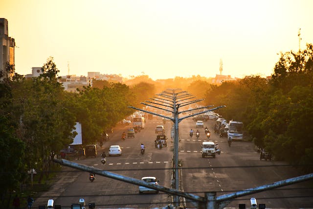
With rapid urbanization and population booms, India’s megacities grapple with unprecedented vehicular and pedestrian congestion. Navigating the daily turmoil of roads and highways demands next-level skills – especially for visitors unfamiliar with the orchestrated madness.
This comprehensive guide covers everything needed to safely transverse the hustle and bustle, from old-school maps to new-age apps, public transport tricks, best practices for driving or riding, ideal routes and roadways, prime travel times beating rush hour, and more. Append the chaos!
The State of City Traffic Today
India’s largest metropolises represent extreme examples of under-developed infrastructure failing to keep pace with exponential influxes of people and cars.
Delhi leads the fray with the world’s worst traffic congestion, according to location technology specialist TomTom. Mumbaikars spend upwards of 200 hours jammed on roads every year. Bangalore ranks #1 for time lost idling during peak hours based on GPS measurements.
Common themes across all major cities include:
- Antiquated roads lacking modern enhancements to bolster vehicle throughput
- Bottlenecks at bridges, tunnels, and junctions with limited entry/exit points
- Perpetual construction and repairs impeding existing lanes
- Peak-hour gridlock extending over 6 hours daily
- Difficult merges from ring roads and highways into city thoroughfares
- Unmanaged intersections facilitating collision risks
- Encroachment of hawkers and homeless along roadsides
- Stray animals darting into traffic freely
- Flooding during Monsoon months further inhibits mobility
As emerging middle classes afford cars and mobility improves for lower-income laborers via rideshares, prediction models forecast exponential expansion of congestion. Proactive navigation adaptions provide the only recourse for preserving sanity.
Digitize Navigation Knowledge
Rather than relying solely on mobile apps to dictate drive-time decisions, proactively mapping out a city area earlier pays big dividends.
Highlight Major Roads and Routes
Obtain paper or digital maps encompassing greater metro boundaries and mark the key artery roads, highways, and bypass routes comprising the circulation paths funneling vehicles across town.
- Ring roads ease cross-city travel via orbital limited-access highways. Delhi’s infected Outer Ring Road stretches 170 KM with links to 30 other roads.
- Expressways like the Eastern and Western Highways deliver North-South connections diminishing commute time across Mumbai.
- Elevated corridors and flyovers attempt to unclog intersections through dedicated vehicle or public transport lanes.
Chart several optimal sequences of thoroughfares to bypass chronic chokepoints. Memorize these as alternative paths for contingencies like accidents or construction.
Pinpoint Perpetual Congestion Zones
Mobile apps like Google Maps overlay colored heatmaps indicating frequent slow zones during different times of day. Additional India-centric navigation tools provide further insights into historical jams:
- Mappls – Offers real-time traffic details specific to Indian city roads with traffic density graphics and trip planning.
- NAM Auto iRAD – Auto dashboard device senses traffic build-up and suggests faster routing. Icons signal difficulties ahead.
Avoid chronic jam zones where possible by charting routes circumventing these areas altogether.
Identify Accident Hotspots
Review traffic reports and news over time to uncover patterns of roadway patches seeing more collisions. Approach stretches known for pedestrians, stray animals, lack of lighting or merge challenges with maximum care when unavoidable.
In Mumbai for example, key hazardous zones include the intersection of Western Express Highway and Dahisar check naka as well as LBS Marg near Ghatkopar West.
Bridge Collapses
A tragic reality across all major cities during Monsoon months is bridge and overpass collapses – typically from aging infrastructure not designed for current capacities.
When reports emerge of such incidents, major rerouting is necessary but difficult with additional flooding affecting viability of roads. Monitor reputable traffic feeds and weather forecasts to steer clear of compromised mobility zones altogether.
Embrace Public Transport Alternatives
In addition to avoidance, clever incorporation of comprehensive metro, monorail, commuter rail and BRT bus options enables bypassing roadways plagued by excessive vehicle counts.
For many city pairs, an optimized combo of walking, rail, and express bus now delivers faster door-to-door transit than driving. Dedicated subway, elevated monorail and bus corridors liberate transit from surface snarls.
Metropolitan Rapid Rail Transport
Quickly expanding subway systems spanning Delhi, Bangalore, Mumbai and more supplement overburdened expressways with underground vehicle-free routes.key benefitss inclue:
- Avoidance of road congestion – Train cars transport thousands of passengers daily rivaling cumulative car occupancies with no exposure to surface snarl-ups.
- Rapid point-to-point times – High-speed electric trains connected stations faster than possible by car in peak hours.
- Consistency – Fixed tracks enable reliable scheduling, unaffected by random expressway issues.
Modern amenities like air conditioning, phone chargers and WiFi transforms frustrating commute hours into productive mobile offices for rail riders.
Downsides compared to flexible personal vehicles encompass limited geographical reach of tracks, crowded cars, and first/last mile transit if stations are not proximal to trip origin and destination.
| City | Metro System | Stations | Ridership |
|---|---|---|---|
| Delhi | DMRC | 285 stations | 3.2 million daily |
| Mumbai | Mumbai Metro | 140 stations | 650,000 daily |
| Bangalore | Namma Metro | 61 stations | 425,000 daily |
Mapping metro access enables quick evaluation of viability for upcoming transits. View Delhi Metro’s extensive network map.
Commuter & Suburban Rail
In tangent with subways, extensive above-ground rail transport pathways also funnel working residents from suburban residential areas into business districts. Networks like Mumbai’s local trains carry over 8 million daily passengers.
Key enhancements like double-decker train cars and first-class or ladies only cars improve otherwise tedious rides for regular riders. Some commuter lines offer faster links from central stations to commercial airport hubs as well – saving the agony of traffic all the way.
Bus Rapid Transport (BRT)
Modern bus rapid transport (BRT) services feature dedicated highway lanes enabling reliable, high-speed trips. Boarding stations resemble metro stops. Apps provide real-time vehicle tracking.
Ahmedabad Janmarg network served as role model for systems now implemented in Pune, Indore, Surat, Vijayawada and more. Delhi’s 23 km BRT corridor handles 100,000 people daily along 18 stations.
Leverage Shuttl or CityFlo apps to confirm efficient routes with expected durations before reserving a seat. Punching the destination results prompts vehicles availability – enabling advance planning.
Rideshares & Micro-mobility
Services like Ola, Uber and Rapido furnish affordable personalized transport alternatives to being trapped in a private car for hours. Added benefits encompass:
- HOV lane usage – Rideshares tap into high-occupancy vehicle lanes offerring faster highway access.
- Predictable pricing – Apps provide guaranteed quotes without price haggling.
- Enroute productivity – Riders can work or relax rather than enduring driving chaos
- Parking skips – Drivers handle parking after dropping you off stress-free.
For even shorter distances of a few kilometers, shared bikes, e-bikes and e-scooters furnish nimble navigation across congested areas via apps like Yulu, Bounce and VOI.
Strategic Route Timing
Randomly heading out onto city road arteries at any hour often backfires. Analyzing directional rush hour peaks guides more judicious timing.
Rush Hour Windows
General tidal traffic patterns hold true across all major cities, oriented around morning and evening office commutes:
- 7AM – 10AM – Roads flood inbound towards urban business centers peaking around 9-10AM. Reverse commute remains light.
- 12PM – 4PM – Lunchtime hours stay moderately busy in both directions.
- 4PM – 9PM – Evening rush hour pipelines roads out of cities typically worst 6-8PM as offices empty.
Scheduling trips along high-demand corridors to avoid the brunt of rush hour crunches ensures speedier travels. Of course variations occur based on schools, industry concentrations and local factors.
Special Events
If transiting anywhere near special event venues, verify no programs coincide with journeys which could attract 100,000+ attendees clogging access routes. These include:
- Concerts at packed stadiums like Mumbai’s DY Patil Stadium
- Sporting matches at venues ranging from Lawn Bowls to IPL Cricket
- Political rallies and campaign events
- Holiday parades and festivals
Avoid several kilometer radiuses around such sites during start and end times when arteries jam by masses arriving and exiting simultaneously.
Alternate Mode Days
To further stacks the odds of no-fuss navigation days, analyze regular schedules for when roads operate under reduced loads.
- Many companies stagger workforces across 6 days per week. Identify lighter commuter days. Fridays typically see fewer commuters than Monday mornings for example.
- National holidays like Independence Day, Gandhi Jayanti, and Diwali also significantly reduce roadway volumes.
- School holidays offer longer midday windows without parent transit spikes.
- Monsoon storms prompt work/school cancellations – leaving roads quiet.
- The annual Jan 26th Republic Day Parade shuts down Delhi’s Rajpath for days – so avoid entirety of Central and New Delhi.
Capitalize on known recurring periods of lowered congestion by aligning trips accordingly.
Night Transit
Late night and early morning hours also furnish less chaotic driving conditions for those on alternative schedules. Overnight from 1AM to 5AM sees minimal congestion with only essential transport on the roads. Early morning 5AM to 7AM offers light traffic as well before mass commuting starts.
Take maximum precautions against fatigue during extended night drives. Stop to rest every few hours and avoid high speeds. Watch for trucks changing lanes and stray animals drawn to headlights. Keep vehicle gassed up as some petrol stations close overnight. Apps don’t furnish accurate overnight duration projections.
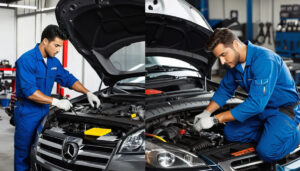
Prep Vehicles for Urban Survival
Given highly unpredictable conditions, safeguarding yourself via vigilant precautions enables stability from within the turmoil.
Gadgets & Dashcams
Sensor-driven gadgets providing supplemental intelligence assist quicker reactions to variable road hazards:
- Dash cams record troubles for insurance claims or online warning clips
- Back-up radar sensors detect objects otherwise lurking in vehicle blindspots
- Aftermarket Android audio units furnish traffic apps on dash displays
- In-vehicle air filters protect from rampant pollution inhaled inside cabins
- Window shades reduce glare helping drivers better view all surroundings
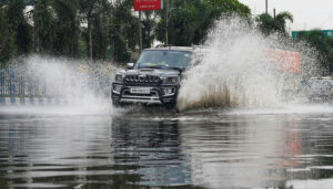
Monsoon Preparations
Waterlogged streets and diminished visibility during Monsoon months merits extra preparations:
- Stock windshield wipers ensuring streak-free visibility
- Verify defogging mechanisms de-mist windows
- Check headlights aligned and high-beams functional
- Ensure good tread on tires with strong grip
- Pack towels and water extraction pumps
Headlight alignment shops like Autobeam optimize night visibility impacted by mis-calibrated beams blinding rather than revealing on slick reflectived roads.
Theft Protection
Unfortunately, stopped vehicles often attract thieves seeking a quick smash and grab – especially for visible mobile phones left on seats.
- Never leave valuables like phones visible
- Disable interior grab handles to prevent reach-ins
- Install aftermarket safety film to prevent glass shattering
- Always lock doors when stopped
- Keep small change available to provide payment insisting thieves move on
Stay Alert!
Demanding roadways commandeer full driver attention lacking any distraction:
- Avoid mobile phone calls, eating or applying makeup when driving
- Stop safely for attending to children in the backseat
- Pull over for programming navigation apps
- Focus on driving without personal grooming
- Take a break if feeling fatigued or overloaded
Defensive Driving
Assume amateur maneuvers by surrounding vehicles and hazards jumping into the roadway requiiring quick evasive actions:
- Cover brake pedals predicting sudden stops
- Watch for bikes ignoring traffic rules coming from all directions
- Keep extra distance from questionable drivers
- Scan multiple lanes in all directions before lane changes
- Lean to see around vehicles obscuring forward view
- Familiarize horn and high-beam controls
Getting comfortable blowing the horn and flashing high beams prompts unalert drivers rather than escalating irritation.
App Arsenal
Mapping apps furnish invaluable ground truth exposing current road snarls with options for re-routing around quagmires. Integrate multiple services delivering well-rounded intelligence from different sources.
Google Maps & Navigation
The search giant’s vastly popular Google Maps platform layers real-time crowd-sourced incident reports atop roadways revealings speed lags quickly. Toolbelt features include:
- Live traffic flow display with delays marked
- Dynamic ETA updates factoring conditions
- Automated re-routing off crammed lanes
- Lane assist during complicated merges
- Save Favorite Places for one-tap directions
- Download offline city maps for when signal drops
Waze offers nearly identical capabilities since Google owns them too. But never hurts having corroborating views.
For those comfortable letting apps pilot vehicles from origin to destination, Google Maps Navigation furnishes turn-by-turn guidance including lane selection and hazard alerts. Voice prompts allow drivers to just follow commands without glancing down frequently.
India-centric Traffic Tools
Domestic developers crafted apps tailored to chaos-control across subcontinent streets. Feature highlights:
- Mappls – Traffic analytics specific to 60 Indian cities show congestion in near real-time helpful avoiding gridlocked zones altogether.
- NAM Auto iRAD – Dashboard mounted device combines GPS positioning, video recording and traffic signal alerts for smarter driving. Rs 4000.
- Delhi Traffic Police App – Get notified directly by Delhi Traffic Cops on restrictions, closures, fines and tow-away zones.
Social Media Feeds
Beyond map visibility, neighborhood social media groups provide ground truth reports of fluid updates:
- Facebook Groups – Residents report observed collisions, protests, road hazards and unusual congestion spots in real-time not yet reflected in apps. Allows pivoting routes.
- Telegram Groups – Hyperlocal channels by zone announce incidents affecting traffic flows with user crowdsourcing enabling avoiding trap zones.
- NextDoor App – In smaller metro areas, neighbors reveal neighborhood issues impacting conduit roads.
Reddit forums like r/bangalore or r/mumbai often furnish questions from visitors where locals reply with related traffic improvements/deterioration details.
Final Last Mile Recommendations
Completing length India journeys relies on stringing together diverse transport modes into suitable chains for getting around efficiently. Blend proactive planning with reactive real-time inputs responding to ever-changing conditions.
- Combine metro, suburban rail and express buses for cross-city transits
- Use ride shares or rentals for Airport station runs
- Park on outskirts and use metro or BRT for final city miles
- Have multiple routes planned for crisscrossing metro areas
- Verify no social events or construction along intended roads
- Time journeys for midnight, holidays or alternate commuting days
- Load multiple traffic apps aong with social media alerts
- Drive defensively assuming anything can happen
- Stop safely to reprogram navigation apps if needed
Stay vigilant of the roadways, prepped for rerouting, and avoid confrontation when encounters arise. Expect extra time cushions to account for unknowable deviations from best laid plans. With these tips in mind, good luck taming the streets!